When I returned to Ulvik from Eidfjord on the ferry there was a bus soon after back to Voss, but there was also a last bus three hours later. Although I’d already had enough beautiful nature for one day, Ulvik looked a nice town; circling the end of one of Hardangerfjord‘s most easterly tributaries.
I enjoyed walking around the town and fruit farms, and felt particularly rewarded in the last hour of my time with the fjords when the sun and blue skies appeared on the snow-capped western horizon mountains, and the last bus drove me towards them.
While I’d like to speed along with the travel25years journey, my travelling life has taught me patience, and that you should enjoy the journey and not just look forward to the destination; as attested to by numerous travellers and writers before me.
So this blog is dedicated wholly to the Eidfjord–Ulvik ferry journey, as I like the mirror reflection photos created as the low cloud of the outward journey cleared.
Eidfjord to Ulvik Photos
And it was patience, and a desire to see as much of the fjords as I could that helped me capture these Eidfjord to Ulvik photos. While the inside of the ferry was warmer and more comfortable; and the weather conditions not ideal; I stayed out on the back of the ferry all the journey, and I think I was rewarded with some great photos.
Although I may be blowing my own trumpet a little there, I fully acknowledge that it was mainly my love of nature that made the photos possible, rather than my photography skills.
It was nature that created the scenes, and they are no doubt created every day in that part of Norway, whether I am there or not. Anyway, here’s the photos; several of which are relevant to this site’s sister site, Folding Mirror Poetry, and the last one to the Greenygreysite:
Update: there are now more Voss, Naeroyfjord and Flam-Myrdal photos creating a folklorish short story involving a viking family, sleeping waterfalls and a lost quest on the greenygrey.co.uk blog.
——————————————————————————
I was hoping to do the Norway in a Nutshell tour on my way to Oslo, but found out in Voss tourist info that it can’t be done as part of the train journey from Voss, only on the whole Bergen to Oslo train journey.
Norway in a Nutshell Naeroyfjord
A bus was leaving to start the Nutshell tour outside the station, so I bought a ticket and was on my way to Norway in a Nutshell, including the steep-sided UNESCO heritage site Naeroyfjord and the steep winding Flam to Myrdal railway line.
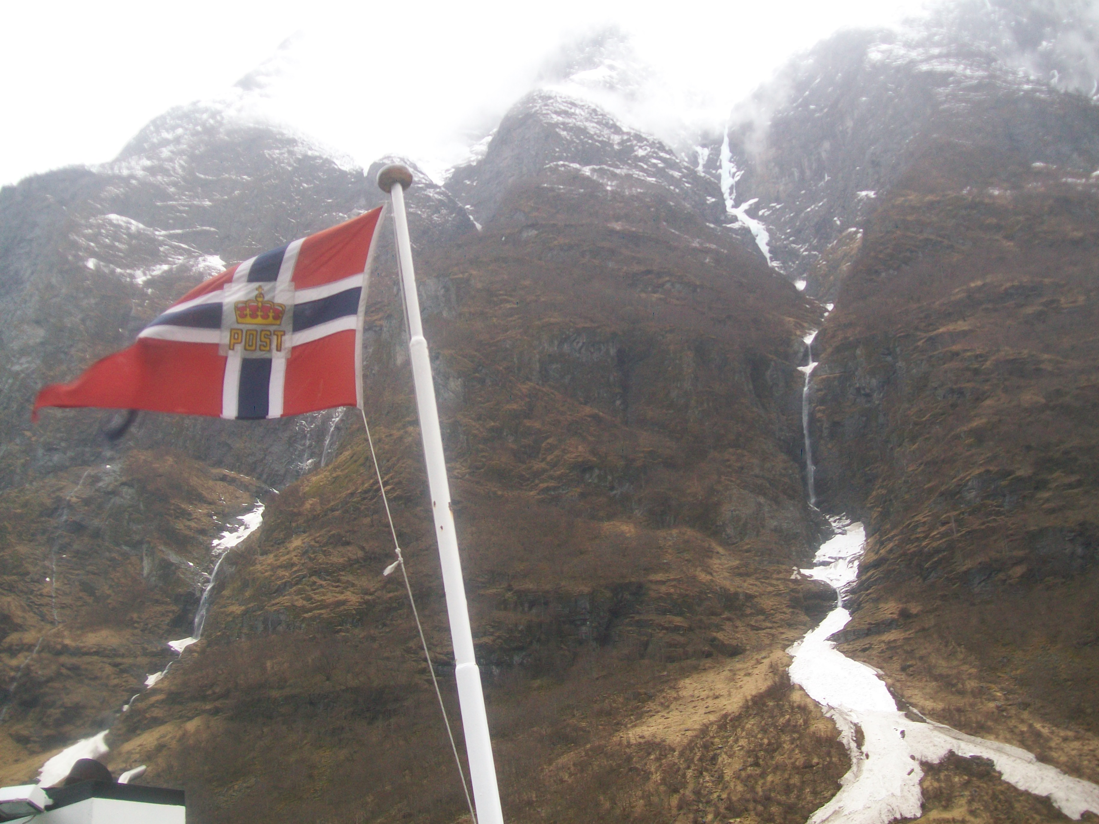
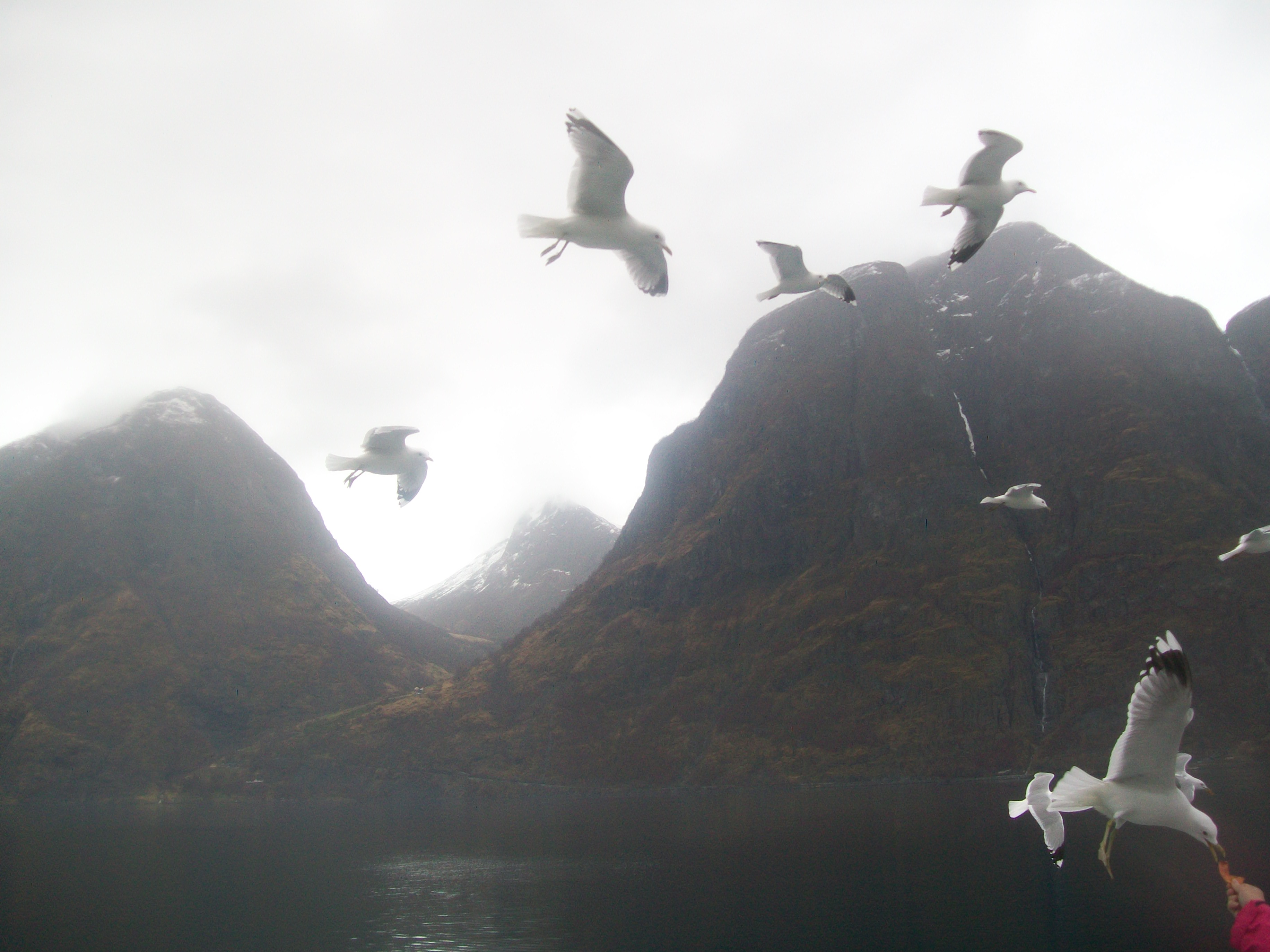
Here’s some photos (they don’t really capture the scale of the Naeroyfjord; cars on the road around the fjord looked matchbox sized!):
Naeroyfjord waterfalls.Norway flag and Naeroyfjord ice waterfall.Seagulls fed by passengers.Narrow waterway through steep mountains.Naeroyfjord village.Trains pass on the Flam-Myrdal trainline.
On April 13th, 2013 I’d used Captain Lawrence Oates‘s famous last words from 1912 on my Greenygrey blog. Suffering from injuries, Oates walked into the Antarctic cold to try and help the rest of the Terra Nova expedition, reportedly telling them he ‘may be some time.’
On May 4th, 2013 that quote and my use of it returned to me, as I scaled Mount Ulriken and walked into thick snow and cloud. My situation was just similar enough to remind me. I cannot claim that the scale of my expedition and problems were anywhere near as massive as the Terra Nova expedition.
Mount Ulriken Videos and Photos
I’d been planning to trek some of the paths on Mount Ulriken on my last day in Bergen, and my guide book said they were well-marked, so I didn’t let the thick cloud and snow stop me.
It worked out well, and I enjoyed the couple of hours I spent in isolation. My feet were cold and wet after falling through thick snow into streams, but adrenalin and imagination fuelled my top half.
I started filming the water, and made it into a five-part Ulriken water video sequence; starting from the top like the water itself, and down to a bridge where I last sighted it.
Runner races ahead as I climb Mount Ulriken for second time.A lone spider on the snowbound Mount Ulriken.Penguin long way from home.Cloud clears to reveal a cabin in ‘Christmas Card’ setting.Route signpost.Descending from the top, finding more water and vegetation.
After yesterday’s blog focused on my hike to Bergen‘s UNESCO site old docks of Bryggen, this post has lesser greenygrey photos from Bryggen. The Greenygrey blog has more photos from Bryggen; of a more greenygrey nature.
Bergen’s Bryggen Photos
On a day of sunshine and showers, the sun shone enough to get some nice photos, bringing out the bright colours of the docks buildings.
In photo 7 you can see the Floibanen funicular in the background. This is a popular tourist attraction providing transport up to Mount Floyen (320 metres) for a good view over Bergen.
The last two photos were taken the next day, as I returned from a boat-trip out to the steep-sided Osterfjord. Photos from that trip next time…
On my third day I returned to the centre of Bergen, having only seen a little of it the first time, when I arrived at the bus station. Heading straight to Bryggen, I ended up going left and circling around Nordnesparken park. I had all day, so wasn’t bothered, and it was a nice detour.
In a double-day simultaneous blogcast with the Greenygrey I’ve divided the photos into pre-Bryggen (the UNESCO site old docks) today, and Bryggen tomorrow; and non-greenygrey photos here and greenygrey ones over at thegreenygrey blog… although there is some greenygrey in these too!
Hopefully you’ll like them so much you’ll visit both blogs on both days. Here’s this site’s pre-Bryggen:
Bergen Photos
Looking back at Mount Ulriken from east of Bergen’s centre, and west of a North Sea arm reaching into the city.Logen Theatre and garden, Bergen.Sardine Factory, Bergen.Storm over Sandviken, looking north from Bergen’s western Nordnesparken park promontory.Bergen old town alley.
Heavy rain, sleet and snow fell in the afternoon. Although this would normally have been bad news, I was quite happy about it. It made me glad I’d climbed Mount Ulriken in the morning; and provided a perfect excuse to sit by the radiator enjoying the morning’s achievement while watching the inclement weather.
It cleared late afternoon, so I went out for a walk. As I’d hiked from the north to the hostel, and planned to return north to see the city centre, I headed south.
I had a nice walk, seeing some ordinary Bergen neighbourhoods, and reaching a hill with views quite far south to a lake. And the hike came in handy a few days later, after I returned to Mount Ulriken and descended from its heavy snow and cloud covered top in an unknown direction.
Here’s some photos of my southerly walk:
Waterfall runs between houses.Lake Nesttunvatnet visible from my end point.Landas church’s greenygrey roof viewed through a greenygrey fence.Storm and sun over Bergen.
Having climbed half way up Mount Ulriken to reach Hostel Montana, I completed the climb in the morning. It had clouded over, but was dry. As Britain had finally started to warm up after a long winter, it was also cold, with temperatures only just above freezing.
Mount Ulriken, Bergen’s Highest Mountain
Mount Ulriken is the highest of seven mountains forming a natural amphitheatre inland from Bergen’s sea.
Ulriken is 643 m (2,110 ft) high; about half the altitude of Britain’s highest mountain: Ben Nevis is 1,344 metres (4,409 ft). Norway‘s highest peak is Galdhøpiggen at 2,469 m (8,100 ft).
Mount Ulriken peak path.Climbers, city and sky.
Frozen lakes visible from Mount Ulriken peak.TV tower on Ulriken.Mount Ulriken map and details.Bergen city, sea and fjord from Ulriken peak.
After a mixture of sunshine and showers on the journey from Haugesund, the sun was thankfully shining bright when I arrived in Bergen. I’d been thinking about getting a city bus up to Hostel Montana, after reading it was up a mountain 5km (3.5 miles) outside the centre, but had also written out a rough map copied from the hostel website.
Bergen Mountain Houses Shine in Afternoon Sun
After seeing the colourful mountain houses circling the city centre shining in the late afternoon sun, as I’d seen in many photos, I felt like walking. So I headed south. After feeling a bit lost, I saw a #12 bus, which is the bus to the hostel.
So I followed the bus route up to the hostel, which was not a light stroll in the land of the troll.
Bergen Sunset Lights Fjord and Houses
While the walk had been quite tough, I was glad I was staying on the mountain when the sun set; which on that April 30th night I was surprised to see was already quite late at about 10.30-11; about the same time as British midsummer.
The fjord lit up like a real fire, and the mountain houses like precious topaz.
Here’s some photos:
Bergen mountain houses.Bergen street.Kong (King) Oscars Gate on the street of that name.Trees line Kong Oscars Gate street.A storm arrived from further south.Bergen sunset from the Hostel Montana.Bergen mountain houses lit by sunset.Bergen sunset darkens and deepens, providing another spectacular photo (in my opinion; not much photography skill required!).
Arriving in Haugesund, there’s a bus waiting for Ryanair‘s cheap flights. You can buy an inclusive ticket from there to the city centre and on to either Bergen in the north or Stavanger in the south. I headed north, and the scenic journey included a ferry ride on the Hardangerfjord. Here’s some photos from the ferry: